Dr. Yeran Sun
Role: Chair
Affiliation: University of Lincoln
Interest: Dr Sun's interests are remote sensing AI; GeoAI; quantitative human geography; sensing mobility and activity; geospatial big data analytics
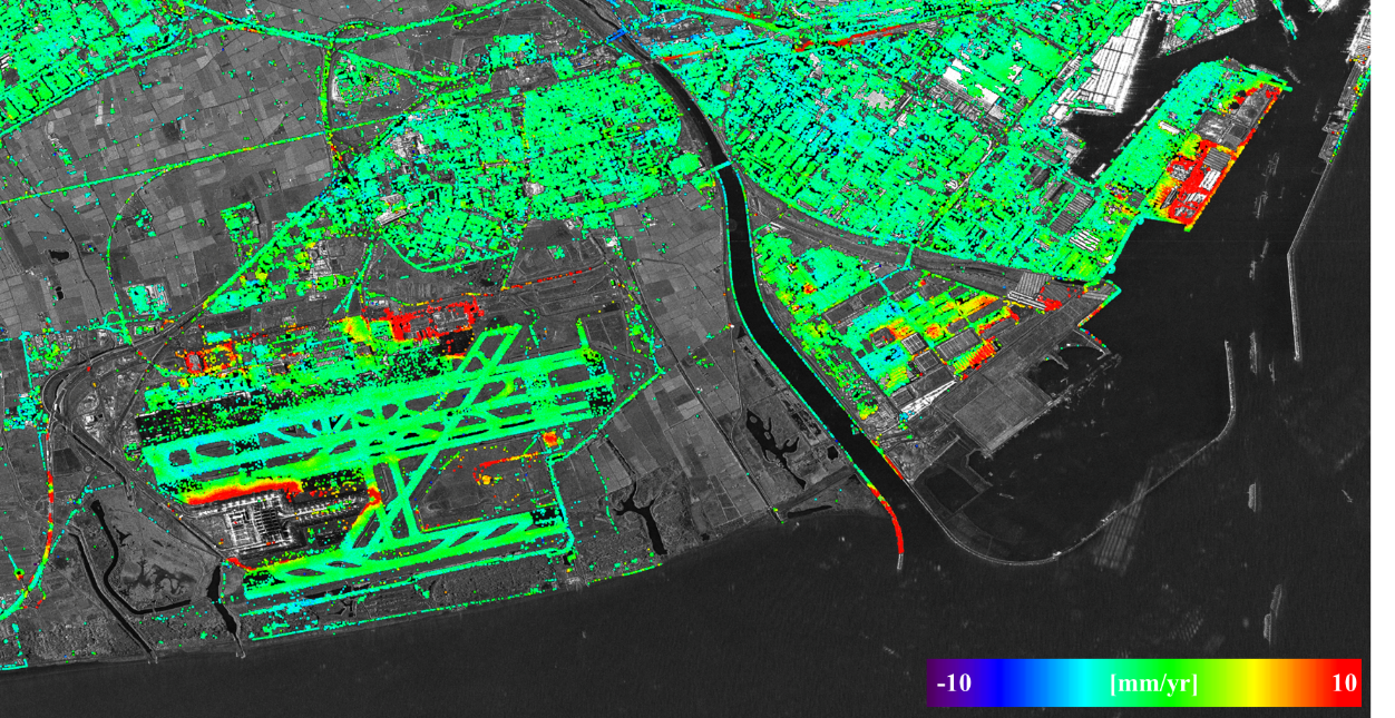
The course will start with an introduction of satellite radar interferometry, a technique based on satellite SAR imagery to monitor land deformation. The key properties of the deformation measurements from radar interferometry will be discussed. Different approaches will be described, which include the techniques based on pair of SAR images, those based on multiple and redundant stack of SAR images, and the newest techniques to perform wide-area monitoring.
The second part of the tutorial will introduce the European Ground Motion Service, the most important wide-area deformation monitoring, which covers Europe. The main characteristics of the service and the product visualization will be addressed. Several examples will be discussed, which can interest a potential wide audience, including scientists and technicians working in the field of deformation monitoring of land, structures, and infrastructures; civil engineers; hydrogeologists; mining engineers; geotechnicians; geologists; etc.
The last part of the tutorial will discuss several case studies, to illustrate how the results coming from SAR interferometry can contribute to different types of applications and to the Sustainable Development Goals.
Centre Tecnològic de Telecomunicacions de Catalunya (CTTC)
Prof. Crosetto holds a civil engineering degree from the Politecnico di Torino (1993) and a doctorate in Topographic and Geodesic Sciences from the Politecnico di Milano (1998). He specialized in Geodesy, Photogrammetry and GIS in Lausanne (EPFL) and Zurich (ETHZ) from 1993 to 1995. He has worked in the Joint Research Centre of the European Commission in Ispra, Italy (January 1999 - July 2000) and as a researcher at the Cartographic Institute of Catalonia. He has formed part of the Institute of Geomatics since 2002. Since January 2014 is with CTTC, where now he is head of the Geomatics Research Unit. His main research activity is related to the analysis of spaceborne, airborne and ground-based remote sensing data and the development of scientific and technical applications using active sensor types
• Abstract
• Short paper
submissions will only be used for participation and reporting
1st December 2025, 2PM EAT
Will be provided soon
Role: Chair
Affiliation: University of Lincoln
Interest: Dr Sun's interests are remote sensing AI; GeoAI; quantitative human geography; sensing mobility and activity; geospatial big data analytics